Sanborn Fire Insurance Maps: UB Libraries Sanborn Maps Collections
Sanborn Maps @ UB Libraries
UB Libraries has two collections of Sanborn maps that may be viewed in-person. The 1991 Buffalo collection can be viewed on microfilm at UB Libraries Annex. In addition, seven volumes of bound 1916-1940 Sanborn Insurance Maps can be viewed by appointment in the Lockwood Libraries Map Collection.
Buffalo, New York 1925
Buffalo, New York 1916-1940 (7 volumes)
These valuable atlases may not be checked out, scanned or requested via Delivery+. Researchers are invited to contact the map librarian (Kim Plassche) to schedule a viewing.
This is an incomplete set. The approximate geographic areas and dates covered for each volume are listed in the below table.
| Volume | Date Coverage | General Geographic Coverage | General Boundaries |
| 1 | 1925 (Corrected through 1957) | Downtown Buffalo | North: Tupper; East: Michigan Ave; South: South Park Ave (Elk); West: Buffalo River/Harbor |
| 1a | 1925 (Corrected through 1958) | Buffalo Waterfront | North: Ferry; East: Michigan Ave; South: Virginia; West: Buffalo River/Harbor |
| 2 | 1926 (Corrected through 1957) | Buffalo | North: Ferry; East: Smith/Fillmore; South: Ohio and Smith; West: Michigan |
| 3 | 1926 (Corrected through 1957) | East Buffalo | North: Ferry; East: New York Central Rail Road Belt Line; South: Broadway; West: Michigan |
| 4 | 1916 (Corrected through 1957) | Buffalo/Black Rock | North: Vulcan/Kenmore (City Limits to Town of Tonawanda); East: Elmwood; South: W Ferry; West: Niagara River (including Upper Black Rock Harbor) |
| 5 | 1935 (Corrected through 1958) | Buffalo | North: Kenmore Ave; East: Fillmore; South: Ferry; West: Elmwood |
| 10 | 1940 (Corrected through 1958) | South Buffalo | North: Seneca St to Mineral Springs; East: Cazenovia/Town of West Seneca line; South: City of Lackawanna line; West: Lake Erie |
Additional details regarding the contents and correction records can be found in the UB Libraries catalog record for the set.
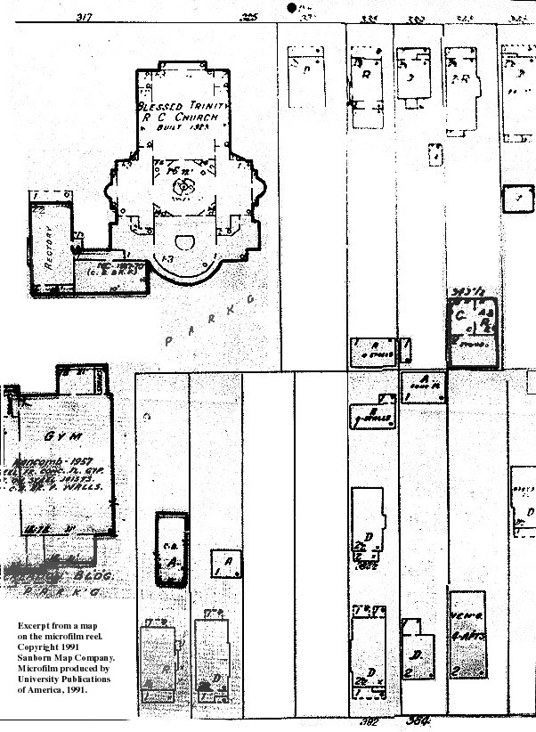
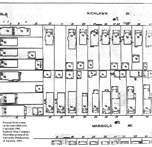
Buffalo 1991 - Microfilm
Buffalo, New York 1991
The University at Buffalo Map Collection has the 1991 edition of the city of Buffalo, on microfilm. This collection provides valuable, detailed property data, showing individual lots, buildings, and dimensions. The reels can be viewed at the Libraries Annex. Below are samples of the detail shown by these maps. See a complete NYS reel list.