Buffalo and Western New York in Maps: Erie & Niagara Counties
Erie & Niagara County Maps
Selected List of Online Maps Showing Erie & Niagara Counties
- Map of Morris's Purchase or West Geneseo In the State of New York, 1804 (David Rumsey Map Collection)
- View of the Country round the Falls of Niagara, 1815(David Rumsey Map Collection)
- Chart of Lakes Erie and Ontario on an enlarged scale, 1816(Osher Map Library)
- Map of the Western Part of the State Of New York, 1825(David Rumsey Map Collection)
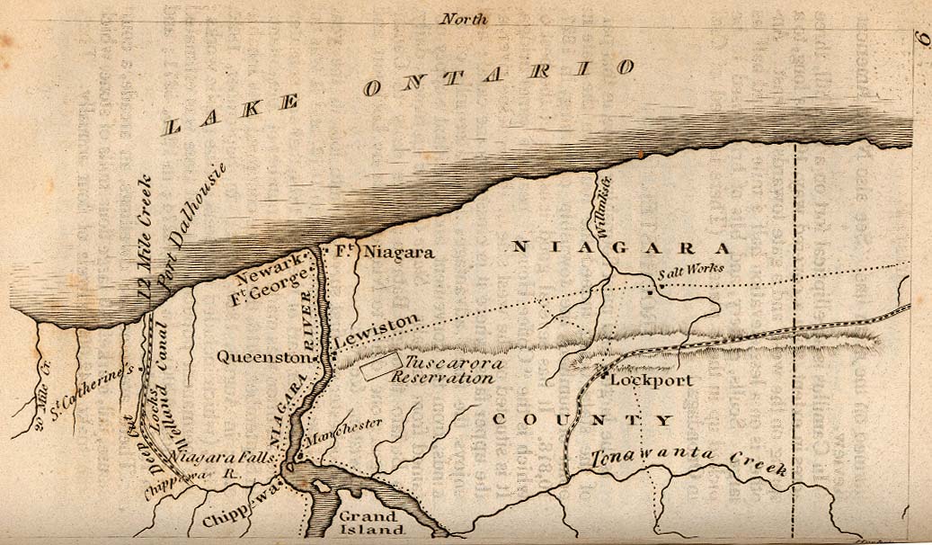
- Falls of Niagara and adjacent country, 1828(Osher Map Library)
- Note name of Grand Island: Grand Ararat
- A new map of New York with its canals, roads and distances, 1840(David Rumsey Map Collection)
- Sketch of parts of Niagara & Erie counties New York, showing approximately the routes of various lines surveyed for the Niagara ship canal, 1868(Beinecke Library)
- Niagara, Erie, Chautaugua, Cattaraugus, Orleans, Genesee, Wyoming, Allegheny, Monroe, and Livingston Counties, New York.; 1870 (David Rumsey Map Collection)
- Road map of Erie County and part of Niagara County, N. Y., 1891 (New York Public Library)
- The Matthews-Northrup up-to-date road map of Erie and Niagara counties N.Y, 1895(Beinecke Library)
- Niagara and Erie counties, 1895 (Beinecke Library)
- Niagara and Erie counties, 1895 (David Rumsey Map Collection)
- Sketch map of a portion of the Province of Ontario and State of New York indicating termini and possible routes of proposed water power canals of companies incorporated to take water from Lake Erie and Niagara River., 1906(Library of Congress)
- Buffalo, Rochester and Pittsburgh Railway and connections, 1910(Beinecke Library)
Additional Resources
- Holland Land Company Maps (New York Heritage Digital Collections: SUNY at Fredonia - Daniel A. Reed Library)
- Western New York County Atlases (New York Heritage Digital Collections: SUNY at Fredonia - Daniel A. Reed Library)
- Niagara River/Lake Erie Watershed Atlas and Bibliography. Regional watershed environmental planning document. Loaded with maps and resources.
Erie County Maps Online
Online Maps of Erie County
Chronological List of Selected Historical Maps
- Erie County, 1829 (David Rumsey Collection)
- Map of Erie County, New York: from actual surveys, 1855 (Library of Congress)
- New Topographical Atlas of Erie County, 1866 (New York Public Library)
- The above link goes to the complete book scan. Pages containing maps of individual municipalities may be found via the NYPL search.
- Atlas of Erie County, 1880 (New York Public Library)
- Online facsimile of copy at the New York Public Library. This is extremely detailed and shows a wealth of data for each town.
- The above link goes to the complete book scan. Pages containing maps of individual municipalities may be found via the NYPL search.
Additional Resources for Erie County Maps
- Buffalo, Erie County, and WNY maps (BuffaloResearch.com). Variety of maps showing historical views.
- Erie Canal Historic maps. Also has current NYS Barge Canal map links.
- Erie County Cemetery Maps. Not all links work, but links for the parent pages will help locate maps.
- Mordecai M. Noah and the Mormon Zion. In the 1800s, Grand Island was considered as the site of the "new" Israel. This is a history of the attempt to establish a World Jewish State in WNY.
- Holland Land Office map, 1825 (UB Libraries)
- Erie County Tax Maps (Official Erie County site)
- Waterfalls in Western New York (UB Libraries)
- List of county routes in Erie County, New York. Has simple maps. Listing of almost 600 CRs.
- Erie County Map Gallery. City, municipal, parks, and environmental maps.
- Erie County Maps & Aerial Photographs
- Erie County Aerial Photographs (1920 and 1951) See also: UB Map Collection, Aerial Photographs.
- Fire Departments in Erie County (Official County site)

Samuel Geil. Map of Erie County, New York: From Actual Surveys (1855). Image Source: Library of Congress.
Erie Towns & Villages
Erie County List of State and Regional Municipalities. Use this list as a starting point to locate local government websites and maps.
Resources for Erie County municipality maps and a selected list of digitized historical maps are highlighted below.
- Akron, NY.
- Amherst (Official town site).
- Digital Maps. Includes: Base map, road map, floodplain, and historical maps.
- Amherst Bike Paths (Town of Amherst). Map of bicycle routes with mileage and other data. Includes paths near UB, including an Inter-Campus route.
- Clarence. Maps.
- Depew, N.Y., c. 1898 (Library of Congress)
- Springville, N.Y., 1892 (Library of Congress)
- Tonawanda (City) Engineering Department Maps.
- Tonawanda (Town) GIS and maps. Includes Aerials, parcel maps, maps showing dates of houses.

Matthews-Northrup Company. Depew, N.Y. (1898). Image Source: Library of Congress.
Niagara County Maps Online
Online Maps of Niagara County
Chronological List of Selected Historical Maps
- Map of the Niagara Falls region, including the Niagara River and the Niagara Peninsula,1790(Library of Congress)
- View of the Country round the Falls of Niagara, 1812(David Rumsey Map Collection)
- The Niagara Frontier, 1830 (Perry-Castañeda Library Map Collection) From The Northern Traveller, and Northern Tour; with the Routes to The Springs, Niagara, and Quebec, and the Coal Mines of Pennsylvania; also, the Tour of New-England. New York, 1830.
- Map of Niagara County, New York, 1852 (Library of Congress)
- Map of the villages of Niagara Falls & Niagara City, New York : the village of Elgin and the city of The Falls, Canada West, 1856(Library of Congress)
- Map of Niagara and Orleans counties, New York; 1860 (Library of Congress)
- Niagara Falls: from surveys executed under the orders of Major C.B. Comstock, Corp of Engineers, Brvt. Brigadier General USA, 1875 (Beinecke Library)
- Map of Niagara Falls showing proposed reservations for the protection of scenery approved by the commissioners of the New York State Survey. And the representatives of the Province of Ontario, 1879 (Beinecke Library)
- Map of the land proposed to be taken by the commissioners of the state reservation at Niagara for preserving the scenery of the Falls of Niagara, 1883 (Beinecke Library)
- Map and Guide of the New York State Reservation at Niagara, 1893 (Beinecke Library)
- New York State reservation at Niagara, 1900 (Beinecke Library)
- Power District of The Ontario Power Company of Niagara Falls, the Niagara, Lockport & Ontario Power Co, 1906 (Beinecke Library)
- The Welland Power District : The Ontario Power Company of Niagara Falls and the Ontario Transmission Co, 1906 (Beinecke Library)
- The Niagara Power District : the Ontario Power Company of Niagara Falls, the Ontario Transmission Co., Limited, and the Niagara, Lockport & Ontario Power Co, 1906 (Beinecke Library)
Additional Resources for Niagara County Maps
- Niagara Falls Guidebooks from the 19th Century. Scanned facsimiles of guidebooks from 1840-1915 in the Niagara University Library.
- Niagara Falls Bridge Commission. Covers entire Niagara River bridge system. With Crossing Traffic Status and links to all government agencies related with US-Canada crossing.
- Local History Collection (Niagara Falls (N.Y.) Public Library). Maps, cadastral plans, other cartographic materials; emphasis on Niagara Falls (city) and area. Dates from mid-19th century on. Also in collection are books, vertical files, and other materials.
- Niagara Falls City School District. No maps.
- Niagara Falls City Schools. Commercial site has map, data, statistics for each school.
- Niagara River Greenway Commission. Action organization to develop and promote Niagara Frontier green spaces.

Samuel Geil. Map of Niagara County, New York (1852). Image Source: Library of Congress.
Niagara Towns & Villages
A selected list of digitized historical maps are highlighted below.
- An enlarged and complete map of the village of Lockport: drawn from the latest maps on file and other authentic survey, 1845. (Library of Congress)
- Map of the village of Lockport, Niagara Co., N.Y., 1851 (Library of Congress)
- Map of the town of Niagara, 1854 (Library of Congress)
- Niagara-Falls, N.Y. 1882 (Library of Congress)

Bernard Callan. Map of the Village of Lockport, Niagara Co., N.Y. (1852). Image Source: Library of Congress.
Access Note
Many of the individual maps listed chronologically have been digitized by other libraries and institutions. Please visit the following websites to view their extensive collections:
- Yale University's Beinecke Rare Book & Manuscript Library
- David Rumsey Map Collection
- Library of Congress
- New York Public Library
- Osher Map Library
- University of Texas Libraries GeoData Portal
- University of Texas at Austin, Perry-Castañeda Library Map Collection
- The Perry-Castaneda Collection website was archived in 2021.
- University of Texas at Austin, Perry-Castañeda Library Map Collection