Great Lakes Essential Resources: Geology
Formation of Great Lakes
Geologic Maps
Geologic map of the Lake Superior region, with sections, 1910. University of Minnesota Libraries, John R. Borchert Map Library.
Quaternary Geologic Map of the Lake Superior 4 x 6 Quadrangle, United States and Canada, 2001. (United States Geological Survey)
Quaternary Geologic Map of the Lake Erie 4 x 6 Quadrangle, United States and Canada, 1991. (United States Geological Survey)


Geological Survey (U.S.), Geologic map of the Lake Superior region, with sections (1910). Image source: University of Minnesota Libraries, John R. Borchert Map Library.
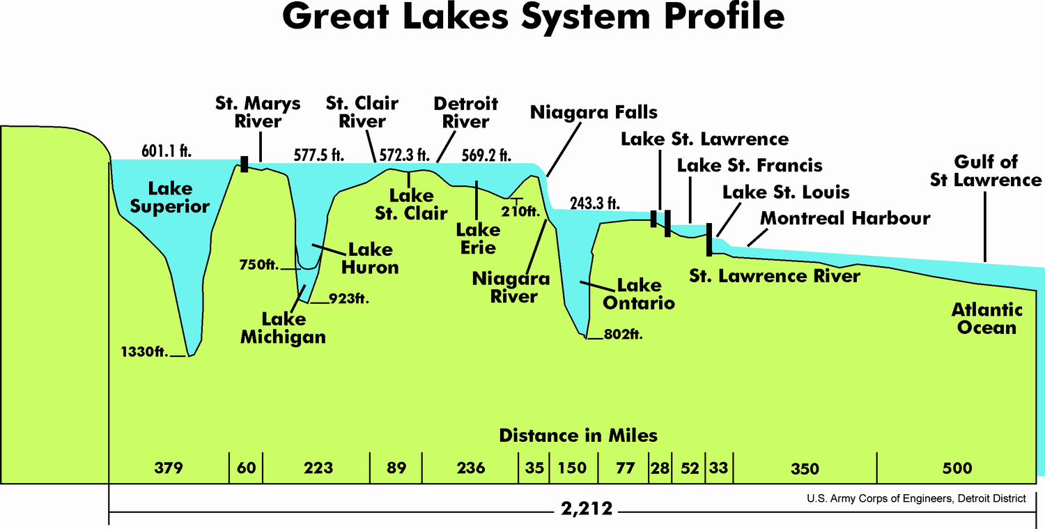
U.S. Army Corps of Engineers, Detroit District, Great Lakes System Profile (2011). Image source: Wikimedia Commons.
HISTORY, Creation of the Great Lakes | How the Earth Was Made (S1, E7) | Full Episode | History. Video source: Youtube.
American Geosciences Institute, Geologic Mapping to Empower Communities: Great Lakes Geologic Mapping Coalition. Video source: Youtube.